
This page is obsolete! Please go to
the new department website.
Directions - How to reach our Department
The address of our department is: Jakob Haringer Strasse 2, 5020 Salzburg, Austria.
Public Transportation
Bus
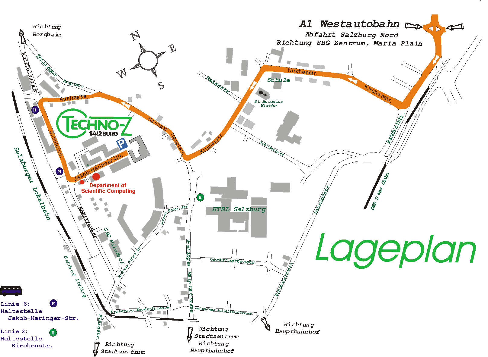
Bus 3: time-table. The preferred stop "Kirchenstrasse" is located on the left side of the second page of the time table. The direction indicator on the bus should say "Itzling Planzmann". When you leave the bus you walk left at the next intersection (downwards). Follow the footway, pass between the post office and the police station. Our department is located in the left (=south) side, after the post office.
Bus 6: time-table. The preferred stop "Jakob Haringer Straße" is located on the right side of the second page of the time table. The direction indicator on the bus should say "Itzling West". When you leave the bus go back some Meters to the intersection, enter the street, go to the first building on the right (=south) side.
When you have the option to choose between the lines 3 and 6, choose 6 because then the remaining walk is less than 50 Meters (compared to 300m from the stop of bus 3).
For more information please visit the web pages of the public transportation service Stadtbus (in german). They also provide a map with all bus routes.
Train
There are several train stops in Salzburg, you should choose the main railway station (Hauptbahnhof). In front of the stations you can see the bus stops, both aforementioned bus lines stop there.
Plane
When you arrive at the Salzburg Airport, take bus number 2 towards "Hauptbahnhof" (the main railway station). There you have to change the bus 3 or 6, and continue as indicated above. Or you go by taxi.
Map, by car
At Salzburg Map in the form on the right side, on the field "Straße" enter Jakob-Haringer-Straße and optionally on the next input field the number 2.
Here is a map provided by Mapquest pointing to our department. They provide a route-planner as well. Another possibility is to use the route-planner by map24.
We also have a simple sketch available. It shows our department on the left side, the bus stops "Jakob Haringer Strasse" (inverse blue H) and "Kirchenstrasse" (inverse green H), as well as the best route by car when you come from the highway.